The Nullarbor Plain is a semi-arid flat plain along the Great Bight Coast. It is almost treeless and stretches from the border of West and South Australia. The Nullarbor Plain spans around 684 miles at its widest point. The best way through this vast plain is the Eyre Highway.
Nullarbor in Latin means “no trees” which is its most striking feature.
The Eyre Highway is a national highway that is 1,034 miles long and connects Western and South Australia. It starts from Norseman, Western Australia and ends in Port Augusta South Australia. The highway is part of the road that connects Perth to Adelaide.

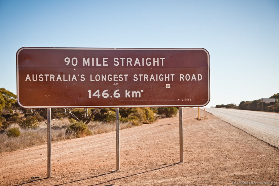
The trip through the Eyre highway will take you through some very interesting tourist spots and scenery. The Dundas Nature Reserve and Fraiser Range along the western end are surrounded by the largest Eucalyptus Forest in the world. Cape Arid National Park offers some stunning white beaches and granite outcrops. If you feel like opening up the throttle a bit, the Ninety Mile Stretch is one of the longest pieces of straight roads in the world.

The Nullarbor National Park is a scenic drive along the Eyre Highway where you pass by the Bunda Cliffs. The cliffs feature steep drops straight to the sea so a bit of caution would be advised. Fowlers Bay Conservation Park is where you can go whale watching or fishing. If you fancy a bit of surfing, Cactus Beach will be the spot for you with its world class breaks.

It is recommended that you take the trip through the Eyre Highway in parts. There are itineraries available on the web that lists all the places to do around the highway. It would be best explored in a week. You can eat and rest in the numerous roadhouses and rest stops along the route. There are some detours to get to tourist spots and historical sites. If you fancy a bit of outdoor camping, there are also campsites where you can spend the night.

While the entirety of the Eyre Highway is paved, there are detours that have dirt roads. It would be best to take a 4WD vehicle with you if you want to go exploring off-road. Remember to keep your car fueled and stock up on food and water. Also, give your car a thorough check before going on this very long trip.

As with any trip, we advise that you take your time exploring the Eyre Highway and the Nullarbor Plain.

There are so many things to see and do and it is best to have a well-planned itinerary beforehand. A bit of research will make the experience a whole lot more fun. So we wish you a fun drive and a jolly good time driving this amazing stretch of road. Oh, and remember to update your watch once you cross the South Australian border as it is in a different time zone.


Leave a reply